


Summit Voting District, Iron County, Utah
About
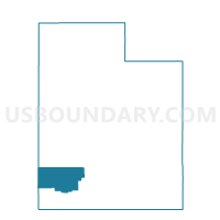
Outline

Summary
| Unique Area Identifier | 678896 |
| Name | Summit Voting District |
| County | Iron County |
| State | Utah |
| Area (square miles) | 40.21 |
| Land Area (square miles) | 40.21 |
| Water Area (square miles) | 0.00 |
| % of Land Area | 99.99 |
| % of Water Area | 0.01 |
| Latitude of the Internal Point | 37.79973000 |
| Longtitude of the Internal Point | -112.93935580 |
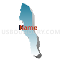
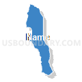
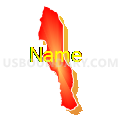
Maps


Graphs
Select a template below for downloading or customizing gragh for Summit Voting District, Iron County, Utah


Neighbors
Neighoring Voting District (by Name) Neighboring Voting District on the Map
- Brian Head Voting District, Iron County, UT
- Cedar City 02 Voting District, Iron County, UT
- Enoch 3 Voting District, Iron County, UT
- Parowan North Voting District, Iron County, UT
- Parowan South Voting District, Iron County, UT
Top 10 Neighboring County Subdivision (by Population) Neighboring County Subdivision on the Map
Top 10 Neighboring Place (by Population) Neighboring Place on the Map
Top 10 Neighboring Unified School District (by Population) Neighboring Unified School District on the Map
Top 10 Neighboring State Legislative District Lower Chamber (by Population) Neighboring State Legislative District Lower Chamber on the Map
Top 10 Neighboring State Legislative District Upper Chamber (by Population) Neighboring State Legislative District Upper Chamber on the Map
Top 10 Neighboring 111th Congressional District (by Population) Neighboring 111th Congressional District on the Map
Top 10 Neighboring Census Tract (by Population) Neighboring Census Tract on the Map
- Census Tract 1105, Iron County, UT (9,698)
- Census Tract 1102, Iron County, UT (7,387)
- Census Tract 1101, Iron County, UT (3,951)